Author: ATOMBOTIX
Time: 2026-04-19
Share


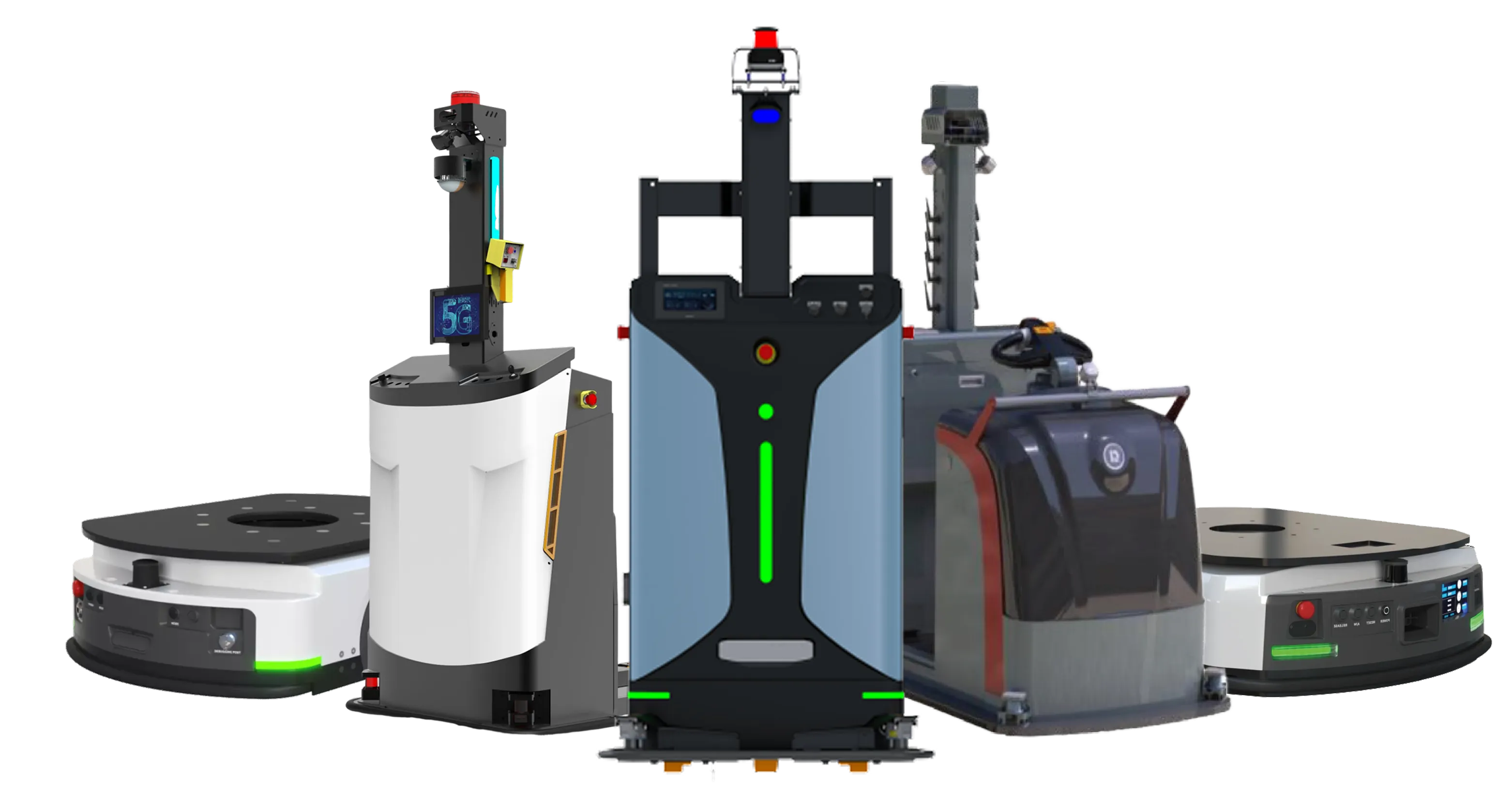
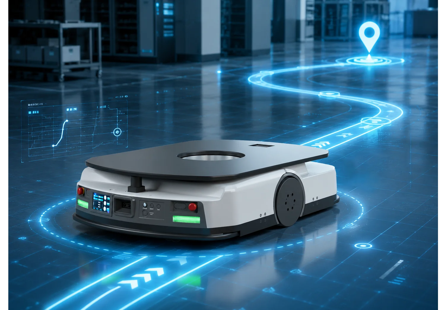
AMR localization and navigation determine whether a robot can accurately understand its own position, plan feasible routes, dynamically avoid obstacles, and complete tasks reliably in complex industrial sites.
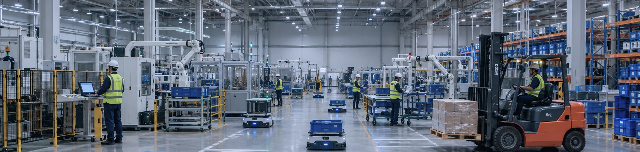
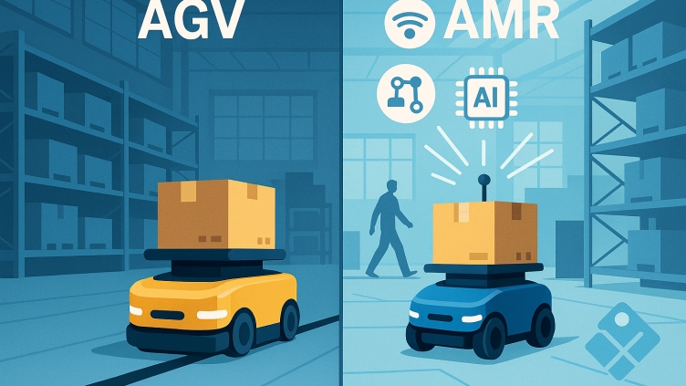
With the growth of smart manufacturing, intelligent warehousing, port logistics, campus delivery, and industrial inspection, AMRs are evolving from simple material-handling vehicles into key execution units for flexible production and intelligent logistics systems. Compared with traditional AGVs, AMRs place greater emphasis on autonomous localization, autonomous path planning, dynamic obstacle avoidance, and adaptability to complex environments.
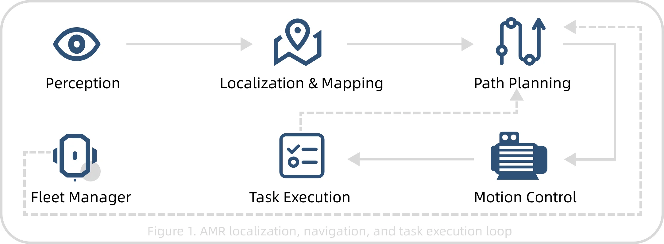
Localization Estimates the robot position and pose in a map or environment coordinate system.
Mapping Uses sensor data to perceive the environment and generate maps for localization and planning.
Navigation Plans and executes routes based on task goals, maps, and real-time environment status.
Obstacle Avoidance Detects people, forklifts, pallets, equipment, and other obstacles, then slows down, stops, or detours.
Fleet Scheduling Assigns tasks, manages traffic, locks routes, and coordinates resources across multi-robot systems.
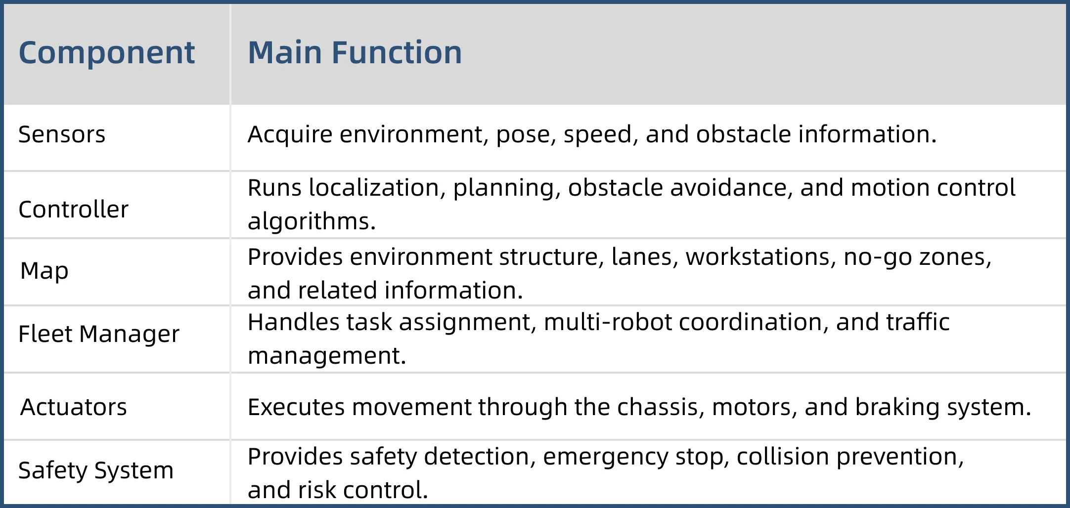
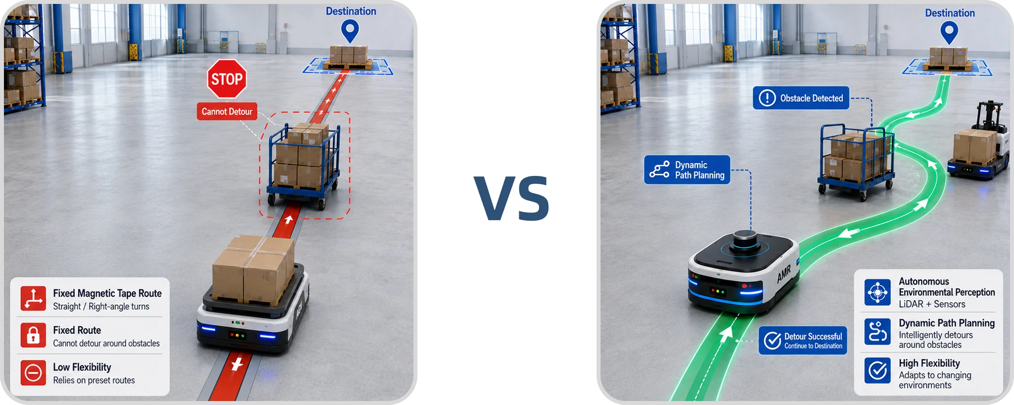
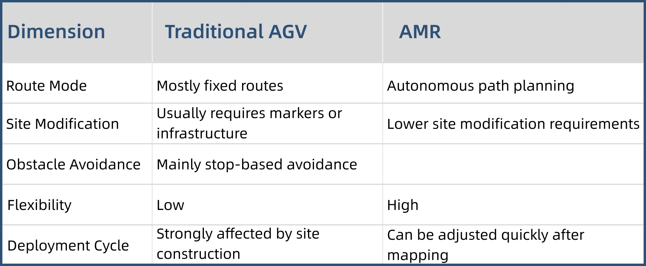
Traditional AGVs often rely on external markers such as magnetic tape, magnetic nails, QR codes, and reflectors to follow fixed routes. Their paths are relatively stable and suited to fixed processes with limited environmental change. AMRs rely more on SLAM, natural feature recognition, and sensor fusion, allowing them to plan routes autonomously and respond to dynamic obstacles.
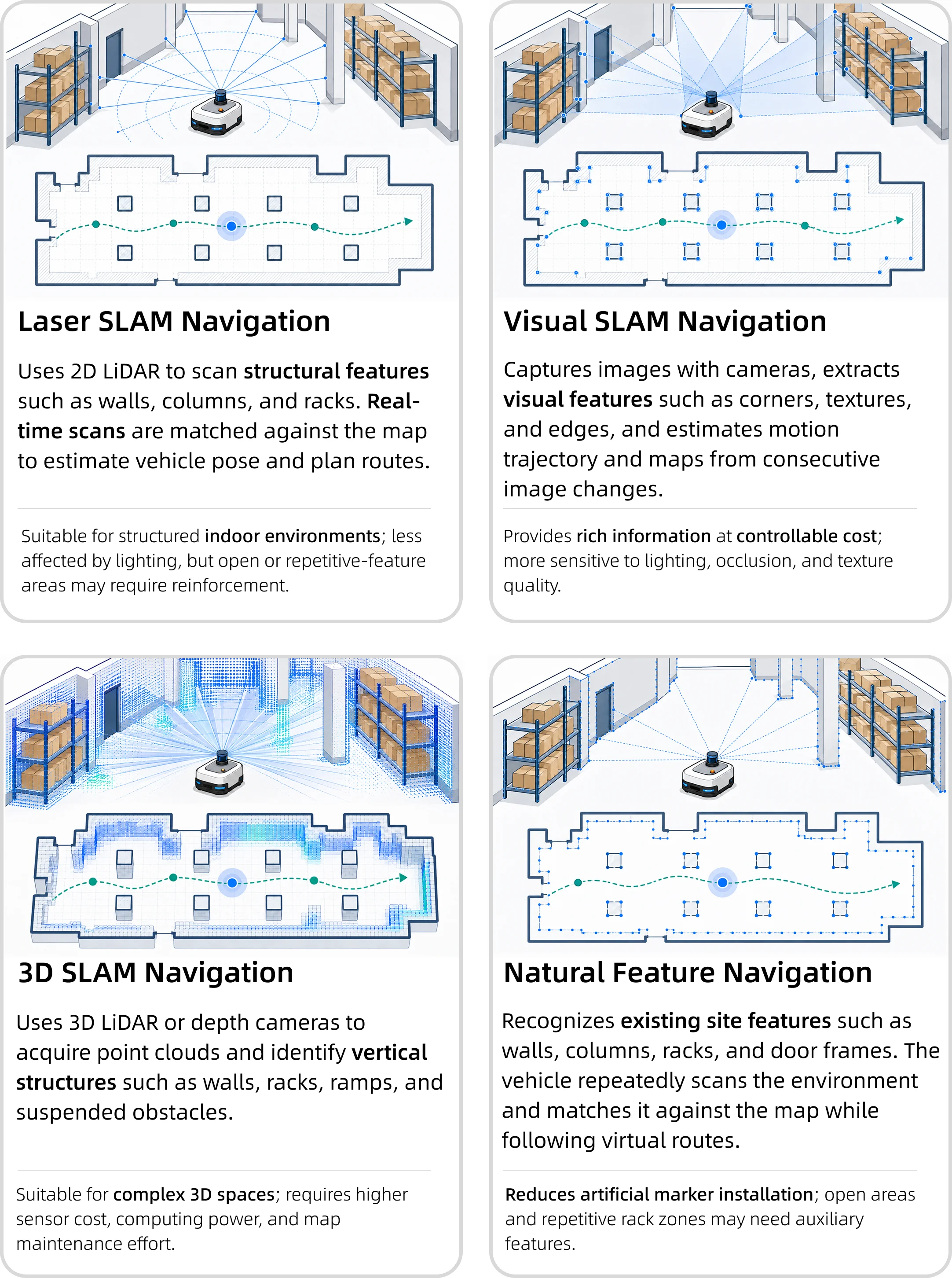
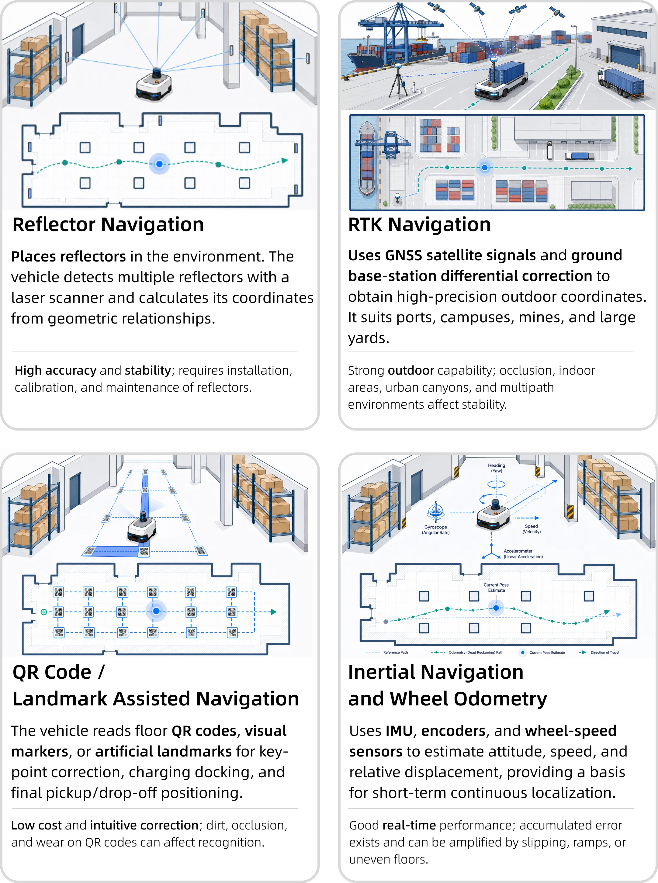
The following simplified diagrams explain the working principles of common navigation technologies. The visual style uses familiar industrial navigation elements such as the vehicle, environment, scan lines, feature points, and positioning sources to help readers quickly understand what each technology depends on and how vehicle position is obtained.
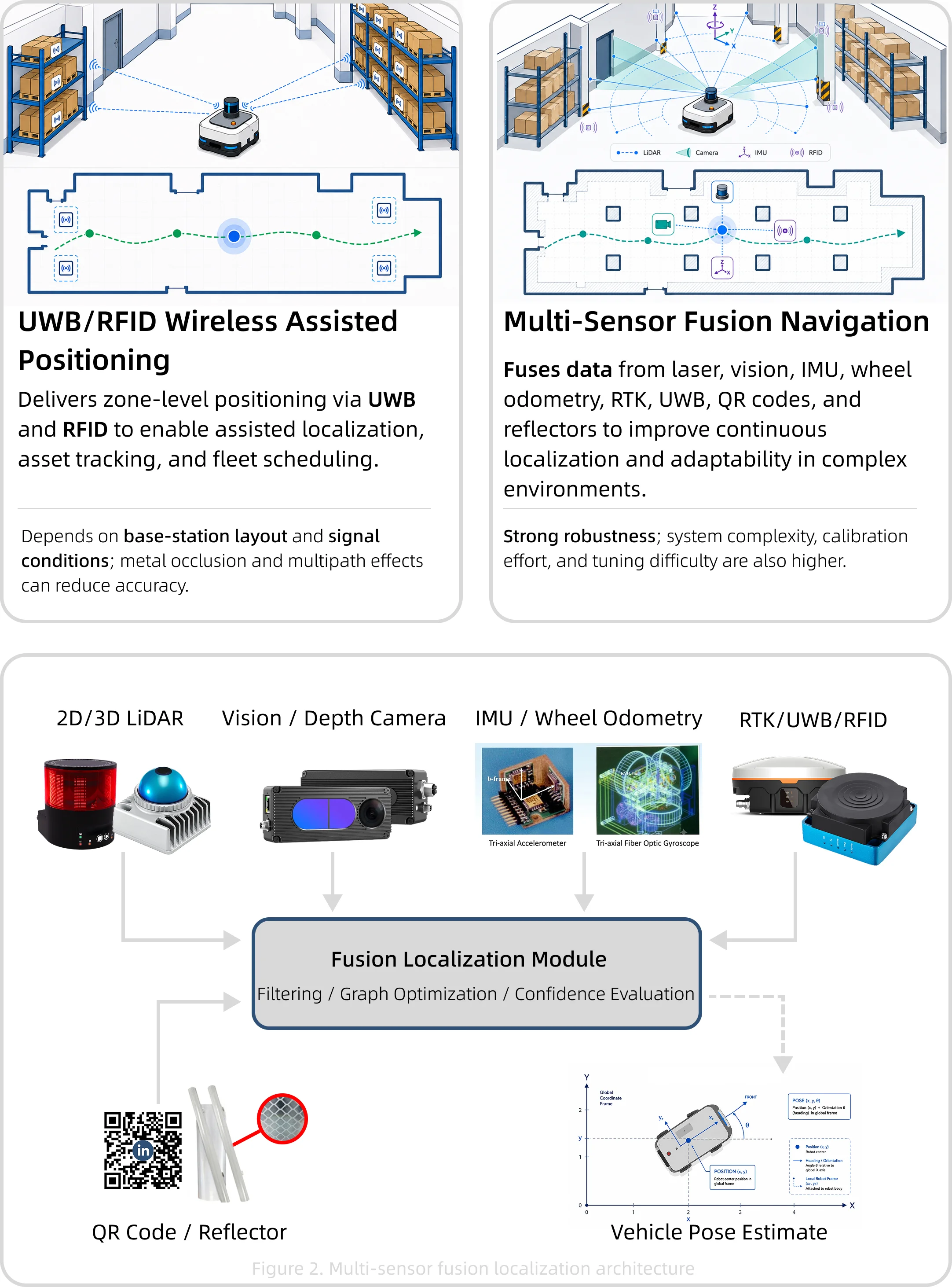
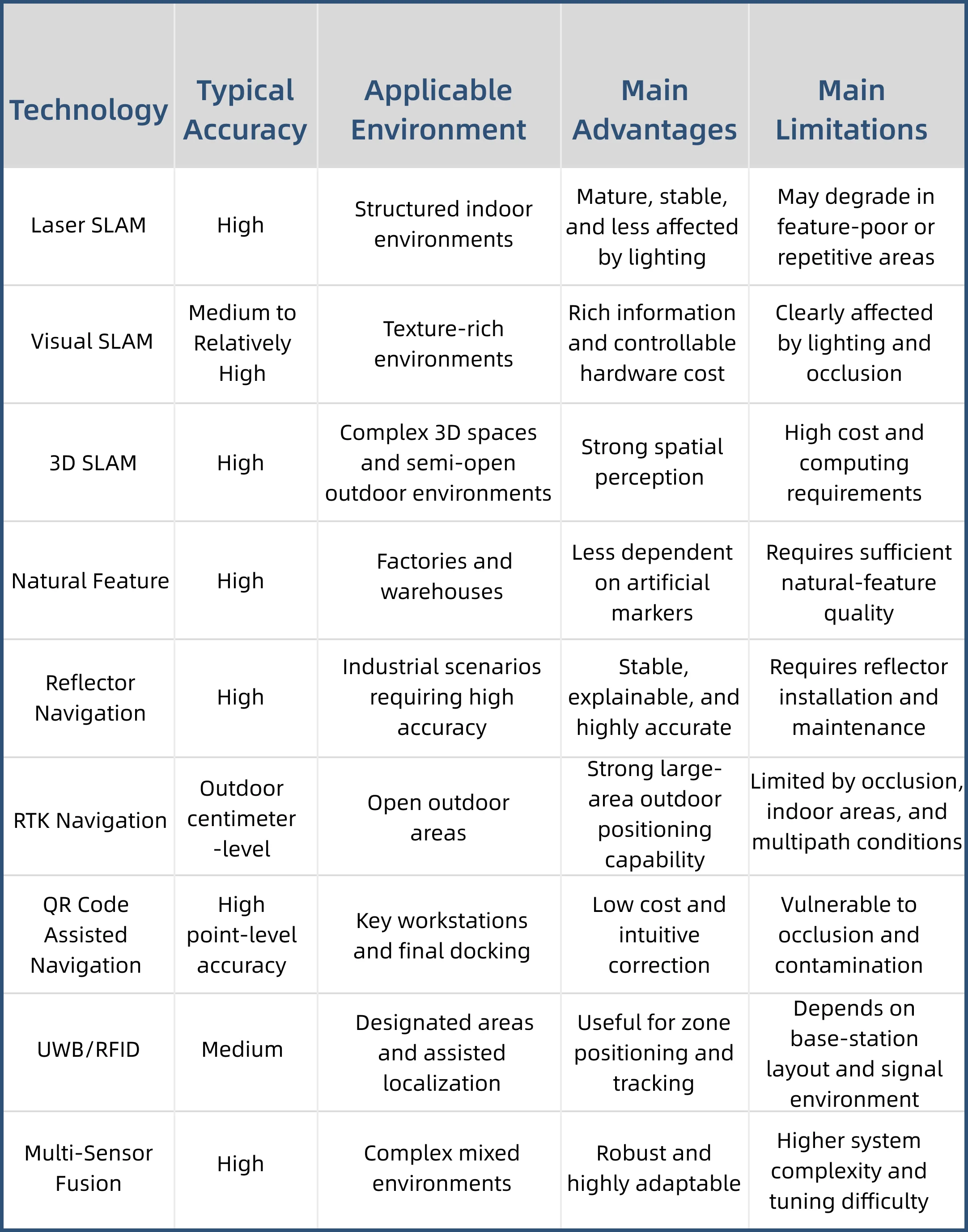
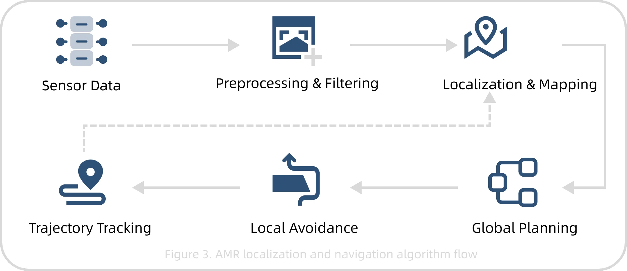
Key algorithms include mapping, SLAM, point-cloud matching, global path planning, local obstacle avoidance, multi-robot scheduling, sensor fusion, object recognition, map updates, and relocalization. Sensor fusion often uses EKF, UKF, particle filters, and graph optimization to improve pose-estimation stability in complex environments.
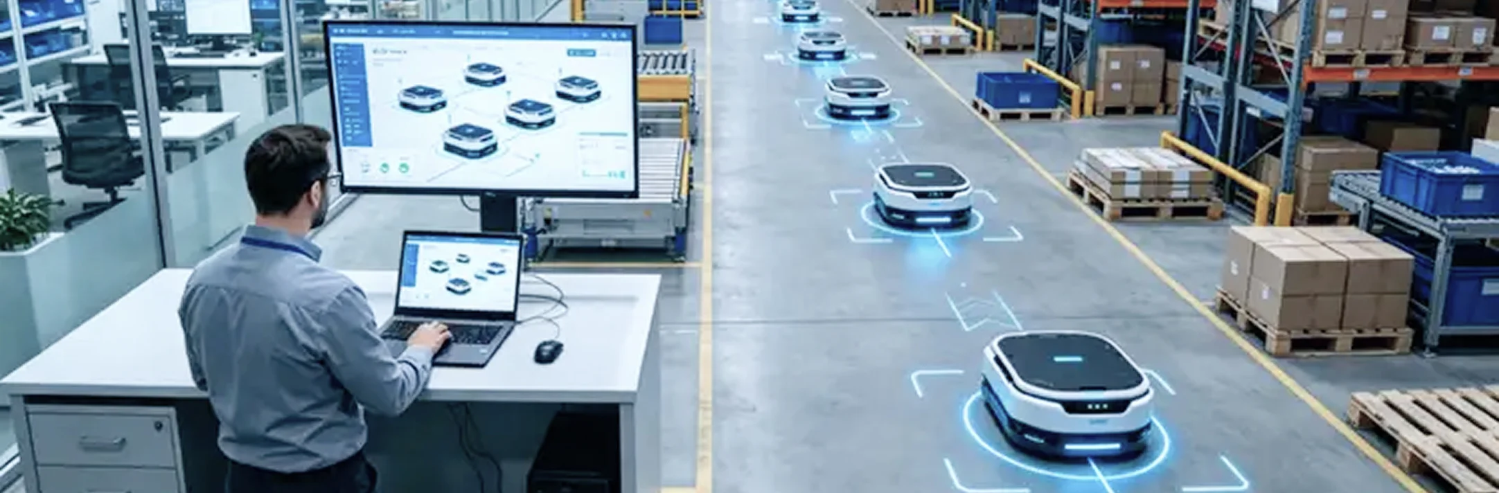
Localization and navigation issues in industrial sites are usually not caused by a single algorithm alone. They often result from the combined effects of sensors, environment, vehicle control, fleet scheduling, and site management.
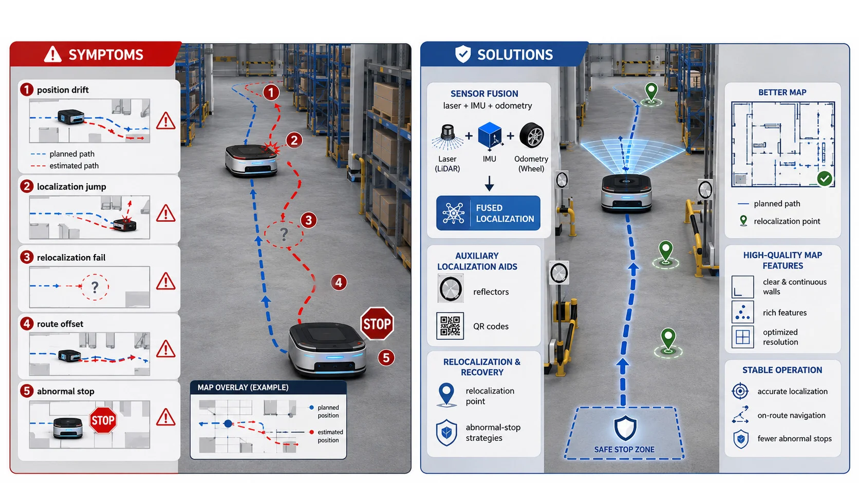
Symptoms: During operation, the vehicle position gradually deviates from the map, or localization jumps, relocalization fails, route offset occurs, or abnormal stops happen.
Solutions: Fuse data from laser, IMU, wheel odometry, reflectors, QR codes, and other sources; improve map quality; add auxiliary localization markers in key areas; configure relocalization points and abnormal-stop strategies.
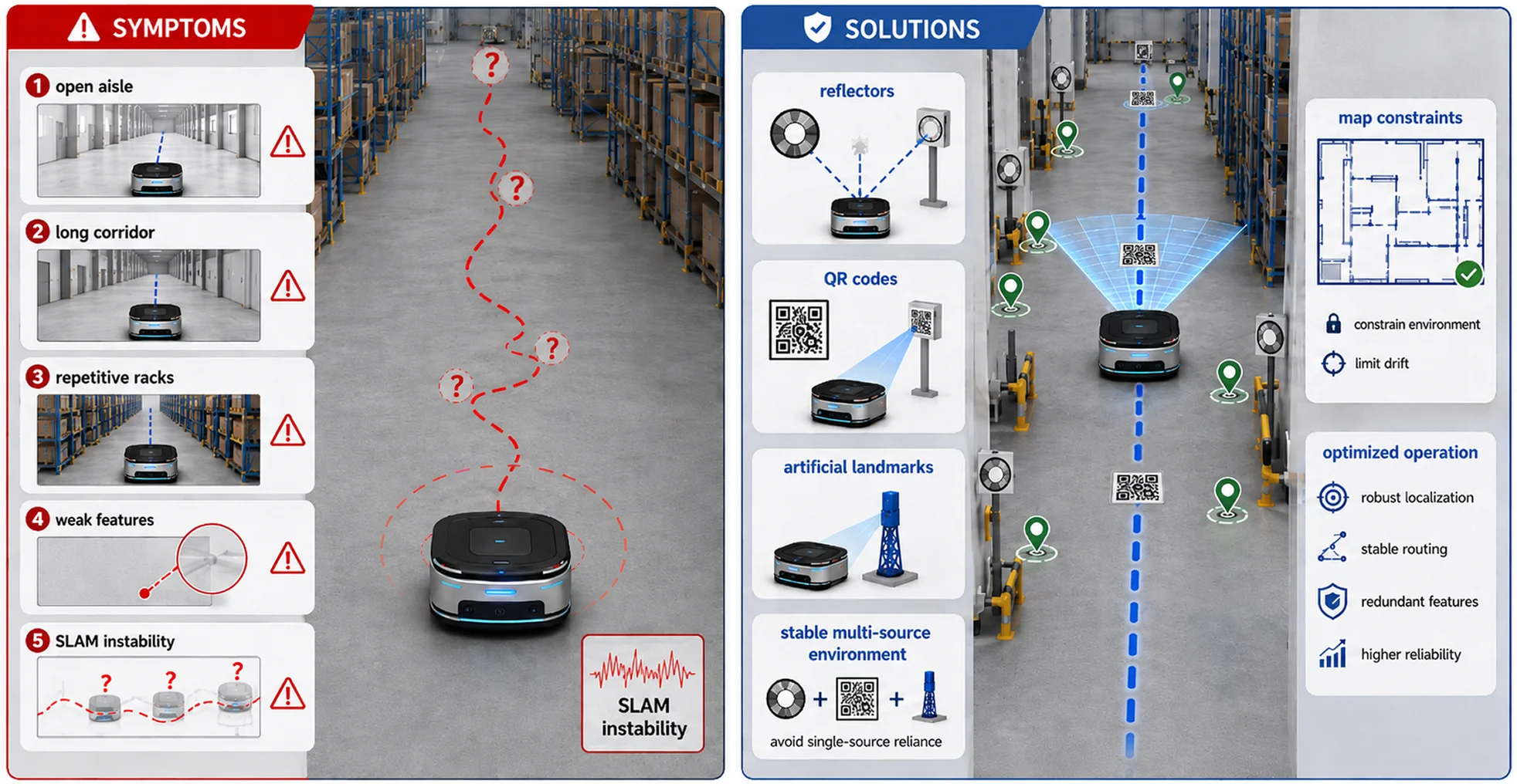
Symptoms: In open aisles, long straight corridors, or repetitive rack areas, Natural Feature or SLAM localization stability decreases.
Solutions: Add auxiliary features such as reflectors, QR codes, or artificial landmarks; optimize map constraints; avoid relying on a single natural-feature source in large repetitive areas.
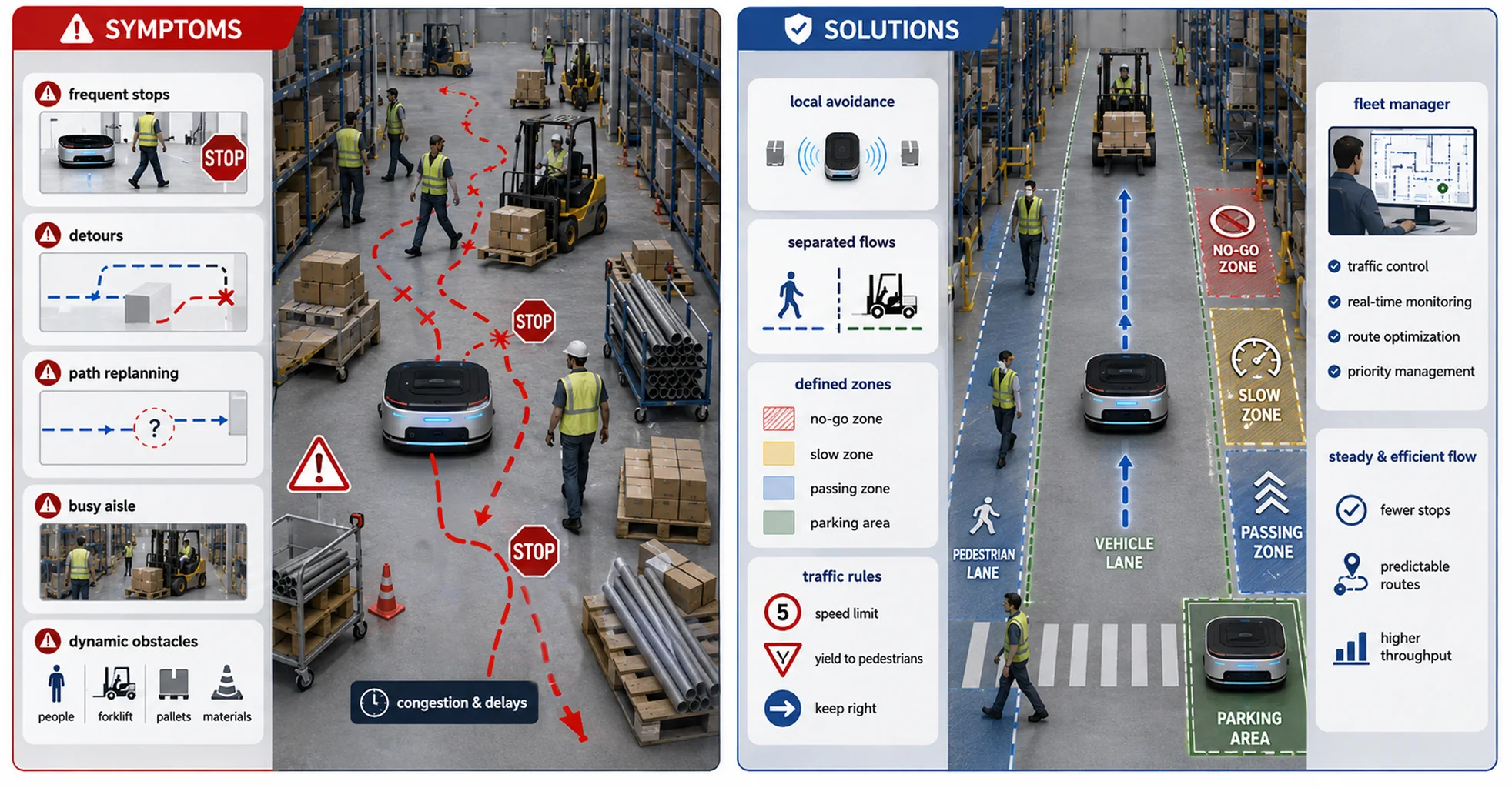
Symptoms: Frequent movement of people, forklifts, pallets, and temporary materials causes repeated stops, detours, or path replanning.
Solutions: Optimize local obstacle avoidance; separate pedestrian and vehicle flows; define no-go zones, slow zones, passing zones, and temporary parking areas; use the fleet manager for traffic control.
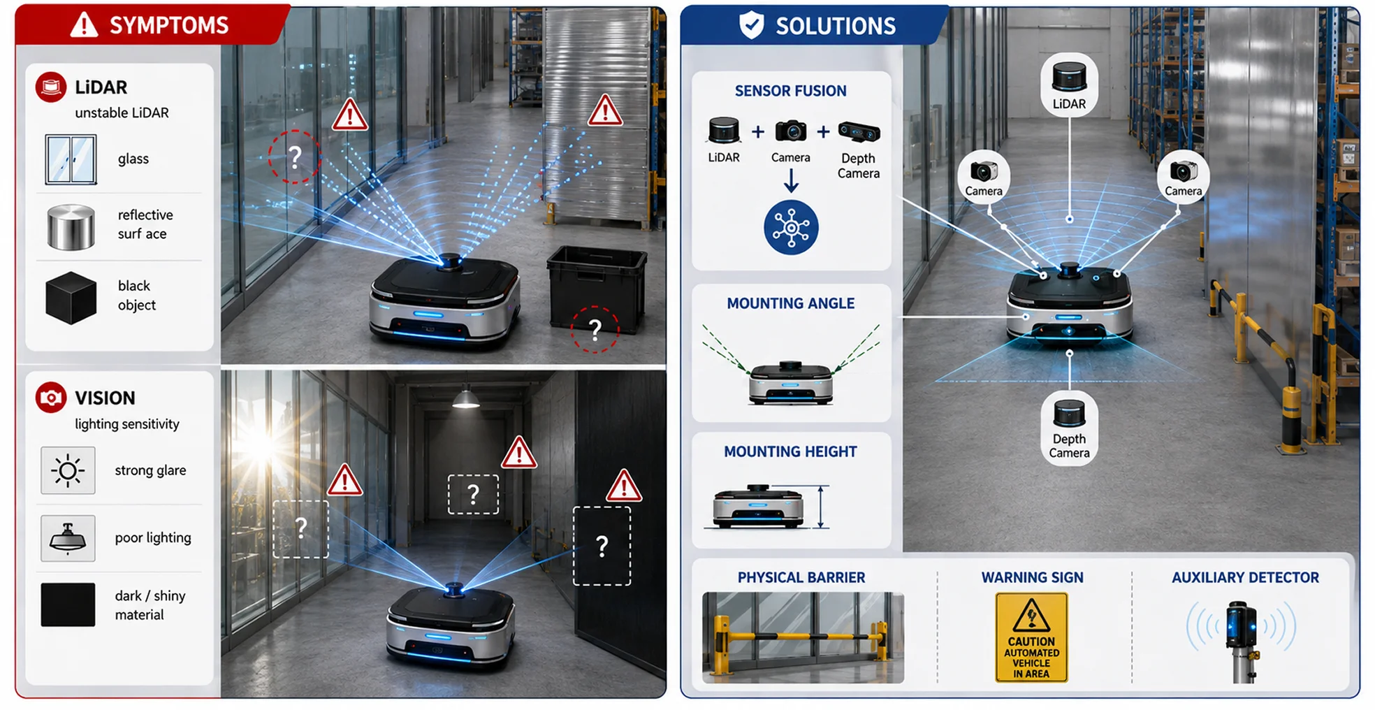
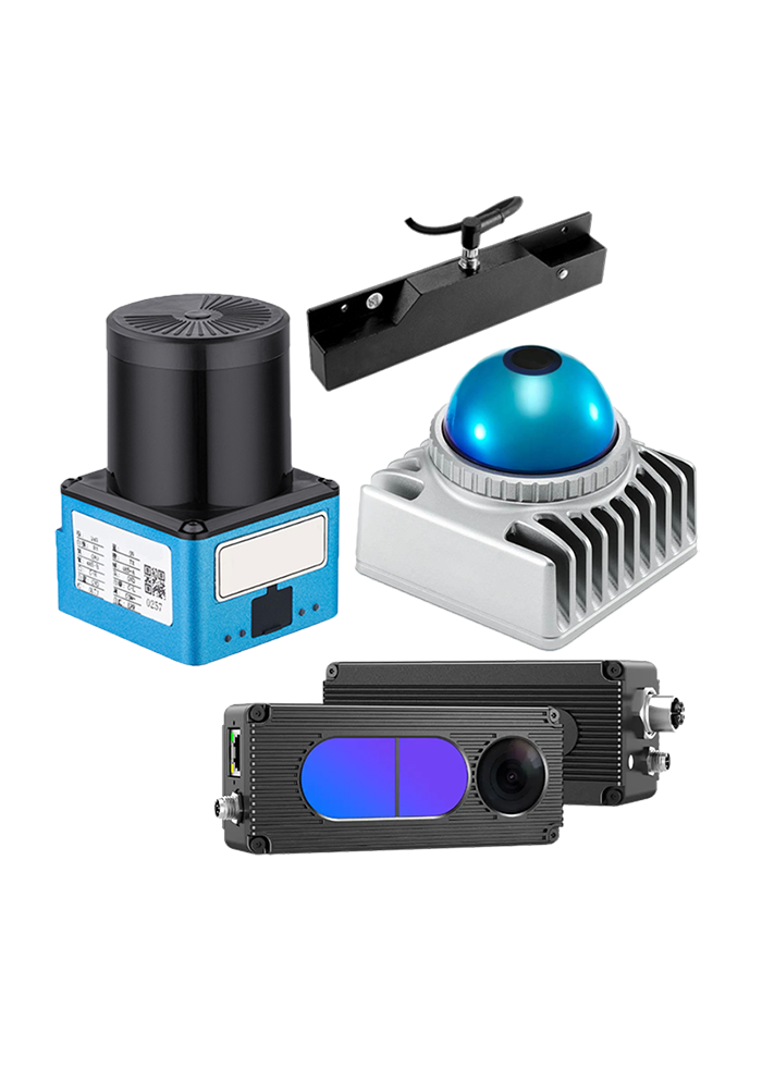
Symptoms: LiDAR may detect highly reflective, transparent, or low-reflectivity objects unstably, while vision systems are strongly affected by lighting and material properties.
Solutions: Use multi-type sensor fusion; adjust sensor mounting angle and height; add physical barriers, signs, or auxiliary detection devices in special areas.
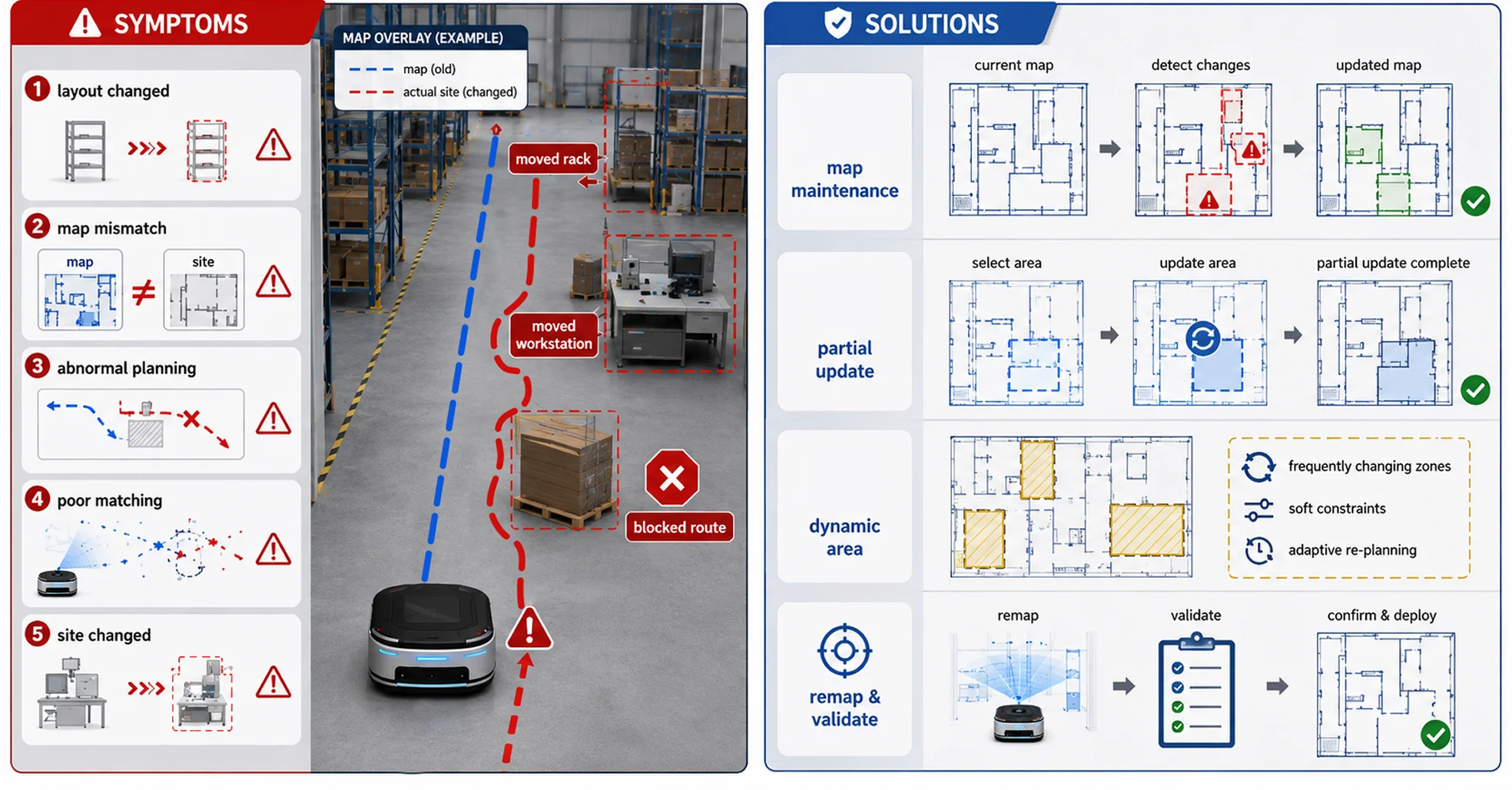
Symptoms: After changes to equipment, racks, workstations, or aisle layouts, path planning becomes abnormal or localization matching degrades.
Solutions: Establish a map maintenance process; support partial map updates; assign dynamic-area attributes to frequently changing zones; remap and validate after major layout changes.
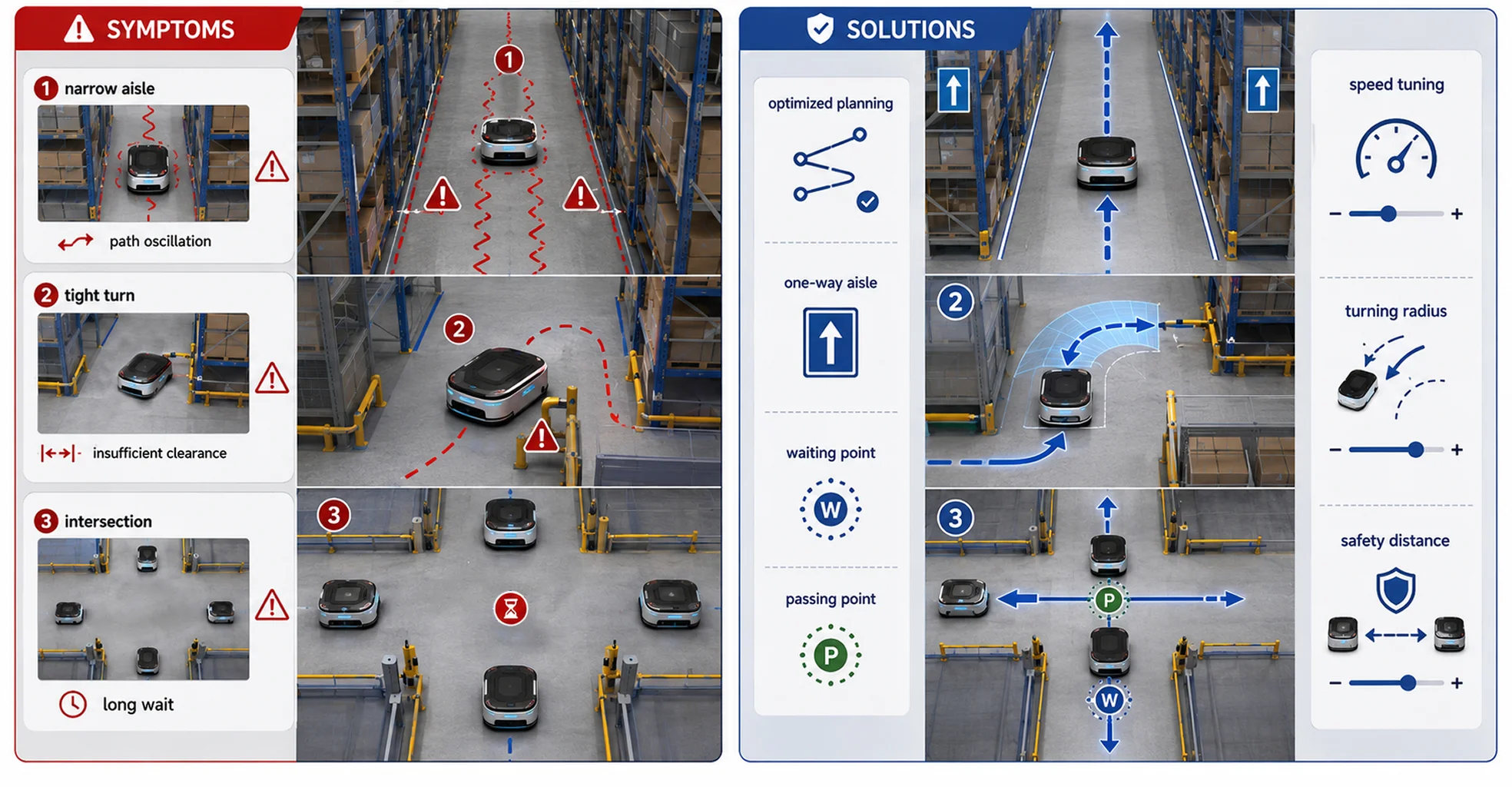
Symptoms: In narrow areas, vehicles may experience path oscillation, difficult passing, insufficient safety distance, or long waiting times.
Solutions: Optimize path-planning parameters; set one-way aisles, waiting points, and passing points; tune vehicle speed, turning radius, and obstacle-avoidance safety distance.
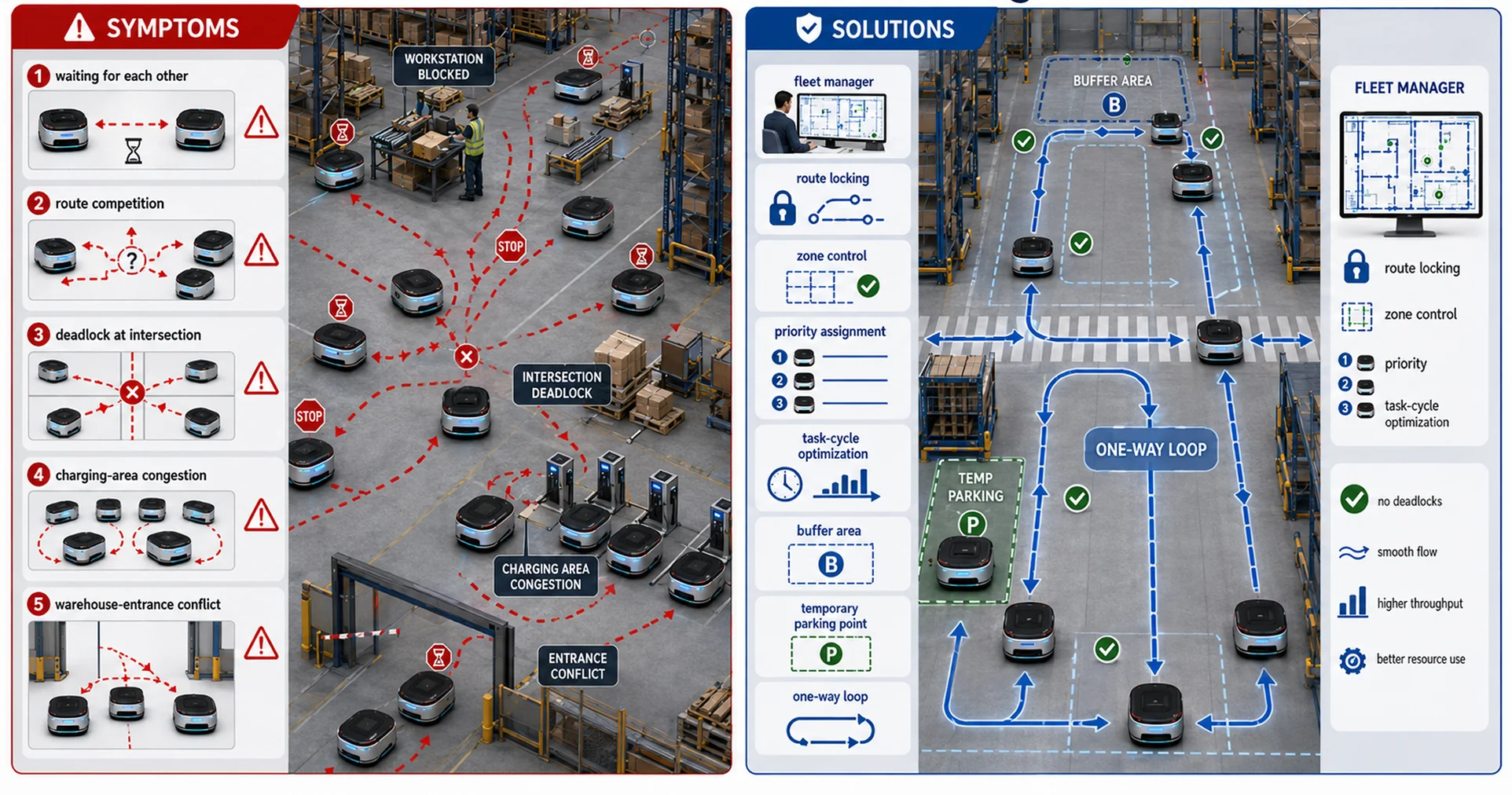
Symptoms: Multiple vehicles wait for each other, compete for routes, or deadlock at intersections, workstations, charging areas, or warehouse entrances.
Solutions: Use the fleet manager for route locking, zone control, priority assignment, and task-cycle optimization; add buffer areas, temporary parking points, and one-way loops.
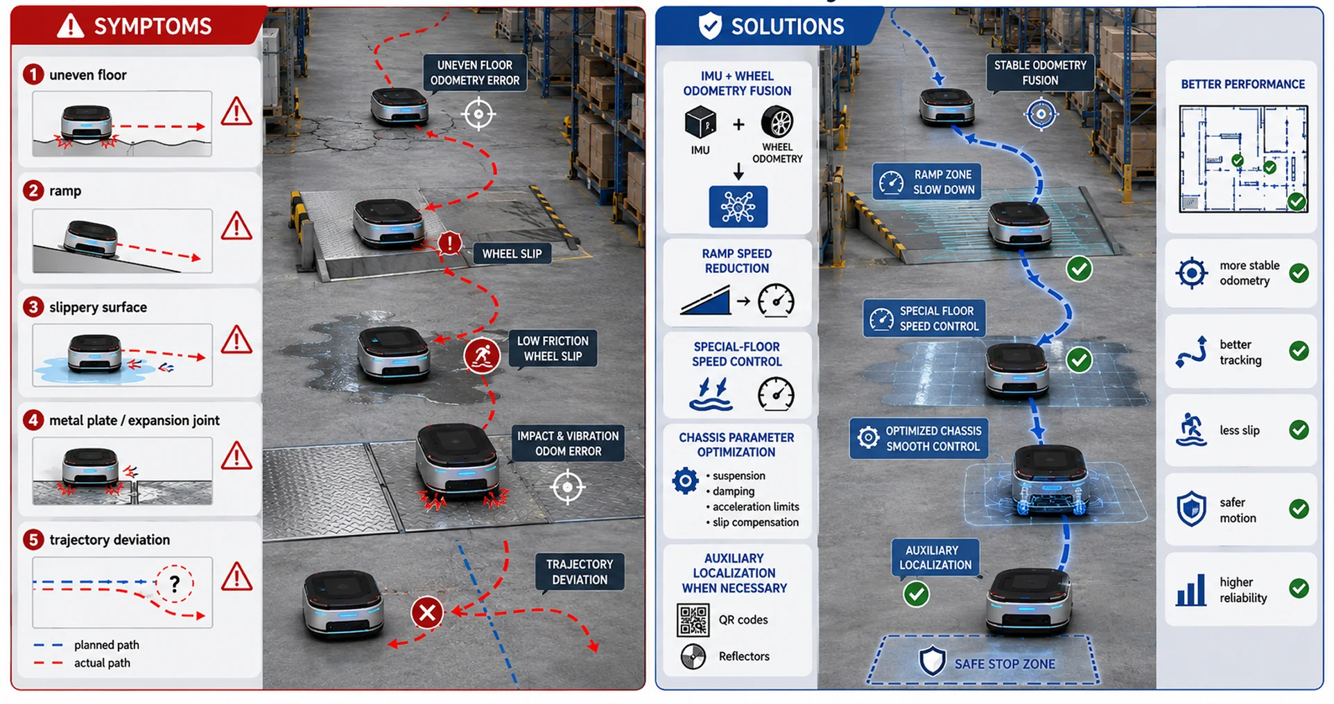
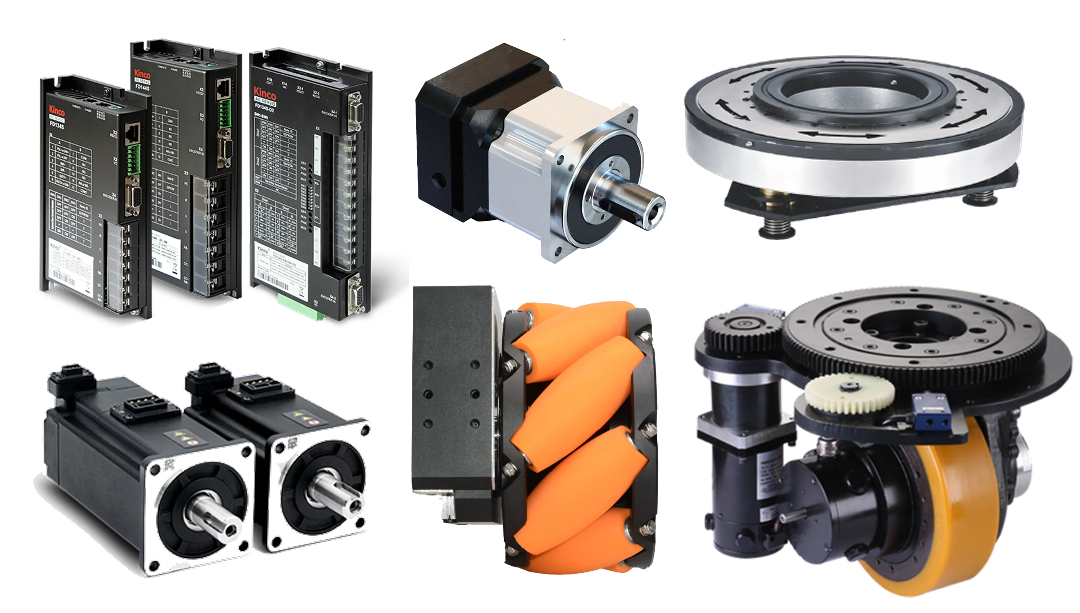
Symptoms: Uneven floors, ramps, slippery surfaces, metal plates, or expansion joints increase wheel-odometry error, cause slipping, or degrade trajectory tracking.
Solutions: Strengthen IMU and wheel-odometry fusion; reduce speed on ramps and special floors; optimize chassis control parameters; add auxiliary localization infrastructure when necessary.
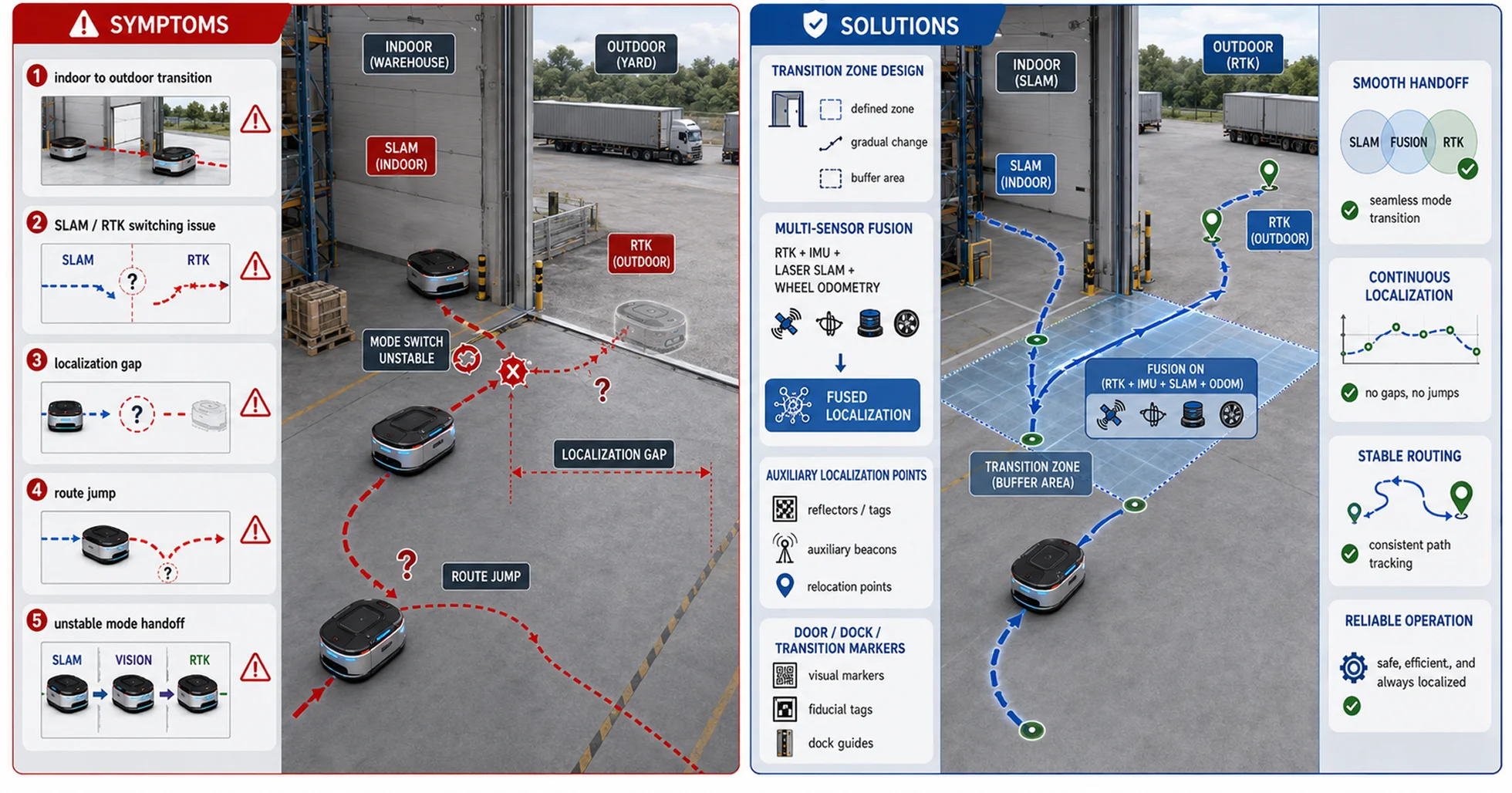
Symptoms: When the vehicle moves from indoors to outdoors, switching between SLAM, RTK, vision, and other localization modes is not smooth.
Solutions: Design indoor/outdoor transition zones; fuse RTK, IMU, laser SLAM, and wheel odometry; add auxiliary localization points near doors, docks, and transition areas.
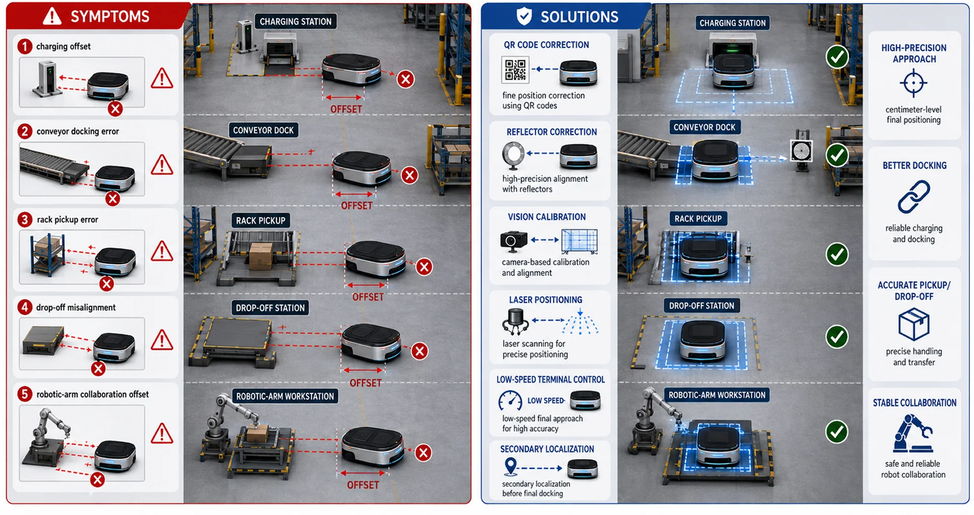
Symptoms: The vehicle has large position errors during automatic charging, conveyor docking, rack pickup/drop-off, or robotic-arm collaboration.
Solutions: Use high-precision correction methods such as QR codes, reflectors, vision calibration, or laser positioning in final approach zones; optimize low-speed terminal control and secondary localization procedures.
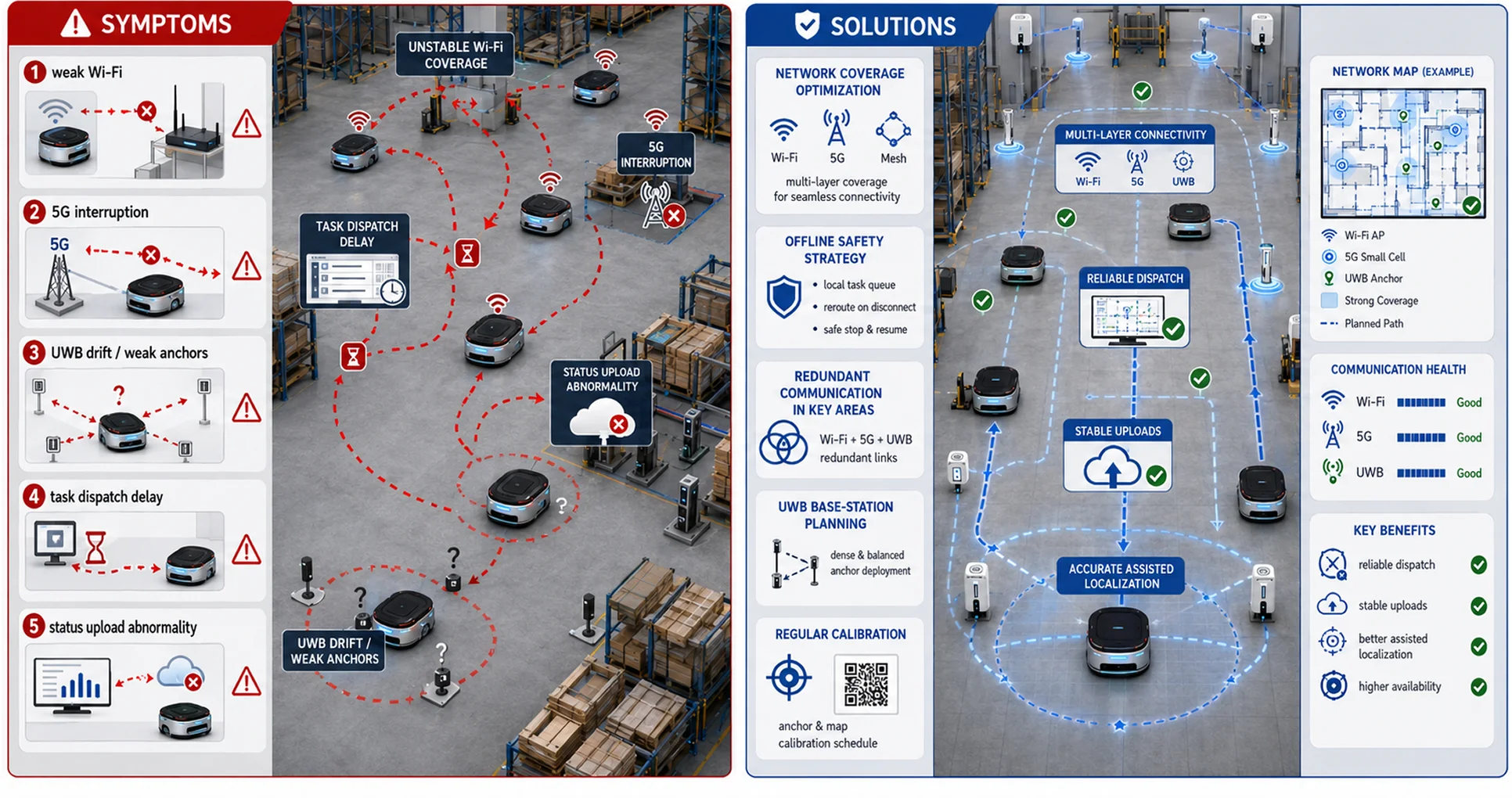
Symptoms: Unstable Wi-Fi, 5G, or UWB signals cause task dispatch delays, abnormal status uploads, or reduced assisted-localization accuracy.
Solutions: Optimize network coverage; configure offline safety strategies; deploy redundant communication in key areas; plan UWB base-station layout carefully and calibrate regularly.
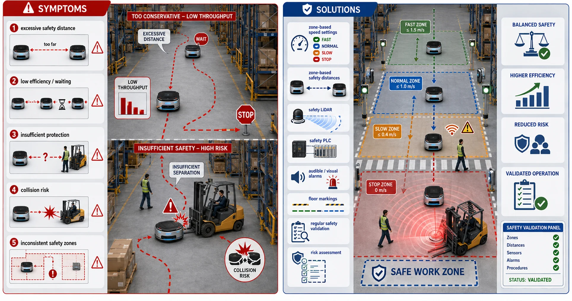
Symptoms: Excessive safety distance reduces efficiency, while insufficient safety strategy increases collision risk.
Solutions: Configure different speeds and safety distances based on zone attributes; combine safety LiDAR, safety PLC, audible/visual alarms, and floor markings; conduct regular safety validation and risk assessment.
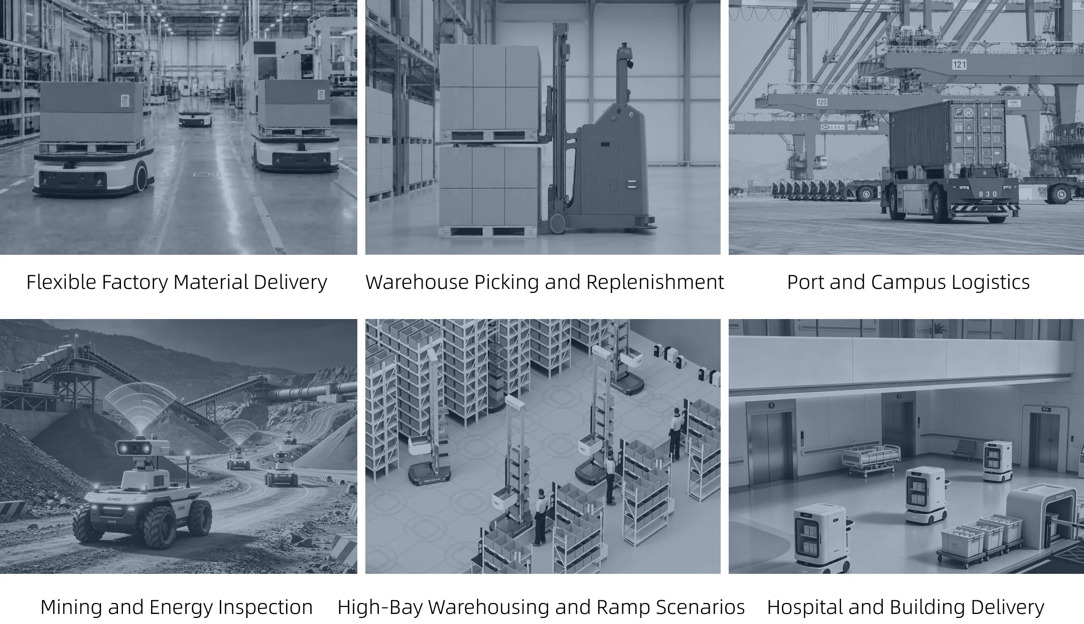
In factory and warehouse scenarios, common combinations include laser SLAM, Natural Feature navigation, QR-code terminal correction, reflector reinforcement, and fleet scheduling. Outdoor campuses, ports, and mines more often combine RTK, IMU, wheel odometry, 3D SLAM, and visual perception. Service scenarios focus more on human-robot mixed traffic, elevator and access-control integration, safety strategies, and interaction experience.
Multi-sensor fusion is becoming mainstream, improving continuous localization in complex environments.
-Localization is moving from 2D positioning toward 3D spatial perception, improving understanding of ramps, suspended obstacles, and complex spaces.
Maps are evolving from geometric maps to semantic maps that include workstations, doors, elevators, no-go zones, and operating rules.
AI enhances perception and decision-making for object recognition, behavior prediction, anomaly detection, and intelligent obstacle avoidance.
Cloud scheduling, edge computing, and digital twins are being combined to improve multi-robot system efficiency.
Integrated indoor/outdoor navigation is improving, enabling AMRs to operate continuously across campuses, factories, and warehouses.
Safety and standardization requirements are increasing, making functional safety, risk assessment, and industry standards more important.
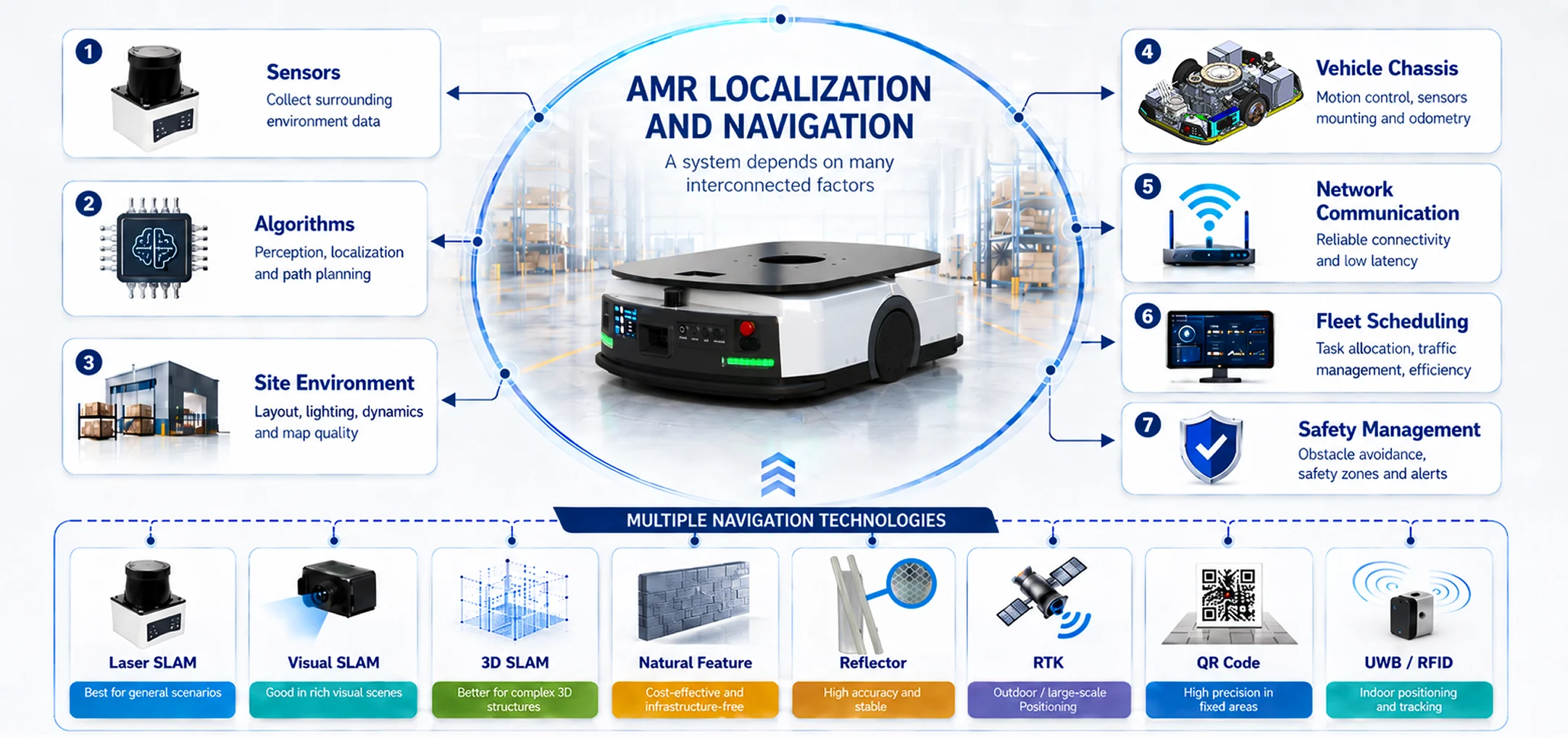
AMR localization and navigation is a comprehensive system engineering topic. It involves sensors and algorithms as well as site environments, vehicle chassis, network communication, fleet scheduling, and safety management. Technologies such as laser SLAM, visual SLAM, 3D SLAM, Natural Feature navigation, reflectors, RTK, QR codes, and UWB/RFID each have their own application boundaries, so real projects usually require scenario-specific combinations.
In indoor factories/warehouses, laser SLAM + natural features + QR correction + reflectors are common. Outdoors (campuses, ports, mines), fused RTK/IMU/odometry/3D SLAM works better. For precision docking, add secondary localization and mechanical calibration.
In the future, AMRs will lean toward deeper sensor fusion, richer 3D perception, smarter scheduling, and more robust safety. When choosing a solution, look beyond accuracy metrics—consider deployment cost, maintenance, environmental changes, operational tempo, safety requirements, and long-term scalability.



 Contact Us